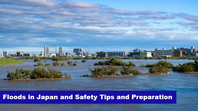
Floods in Japan and Safety Tips and Preparation
Japan, located in the eastern end of Monsoon Asia, one of the world's rainy regions, has an average annual rainfall of 1718 mm, which is about twice the global average (880 mm).
Moreover, the precipitation in Japan fluctuates greatly from season to season, and is concentrated in the rainy season and typhoon season.
Rainfall Intensity and Definitions of Terms
| Precipitation Intensity (in an hour) |
Forecast Terms |
Situation |
| 10 - 20mm | Moderate to Heavy Rain (やや強い雨 - Yaya tsuyoi ame) |
Rainfall of the amount enough to create puddles on the ground. If it lasts for a long time, stay alert for possible flooding. |
| 20 - 30mm | Heavy Rain (強い雨 - Tsuyoi ame) |
Pouring rain to the extent that holding up an umbrella is not helping to protect yourself from rain. Gutters, sewage systems and small rivers will be flooded, while minor landslides occur. |
| 30 - 50mm |
Very Heavy Rain |
Bucketing down of rain. The road becomes like a river, and the cliff collapse easily occurs. |
| 50 - 80mm | Extreme Rain (非常に激しい雨 - Hijôni hageshii ame) |
Downpour like a waterfall. Severe rain that turns surrounding air white and makes it difficult to see clearly. There is a possibility that the water can pour into underground shopping centers. |
| 80mm and more | Torrential Rain (猛烈な雨 - Môretsuna ame) |
Heavy downpour that makes the air stifling. Strict vigilance is required as it can result in a catastrophic disaster |
Reference from Japan Meteorological agency
Localized Heavy Rainfall - Guerrilla Rainstorms
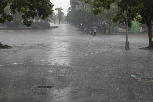
Localized heavy rainfall is called "Guerrilla Rainstorms (ゲリラ豪雨 - Gerira-Gôu)" in Japan. It's a localized downpour of short time.
Guerrilla Rainstorms have been increasing in Japan in these years. This type of rain is unexpectedly strong and is also very difficult to predict exactly where it occurs. Sewers and small rivers may overflow and it can cause serious damage.
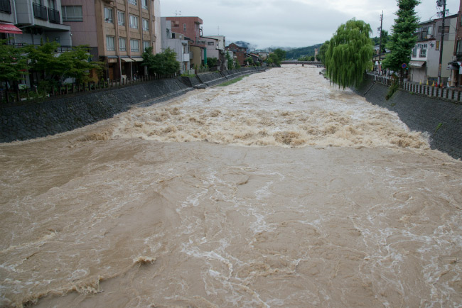
Japanese rivers flow higher than residential area
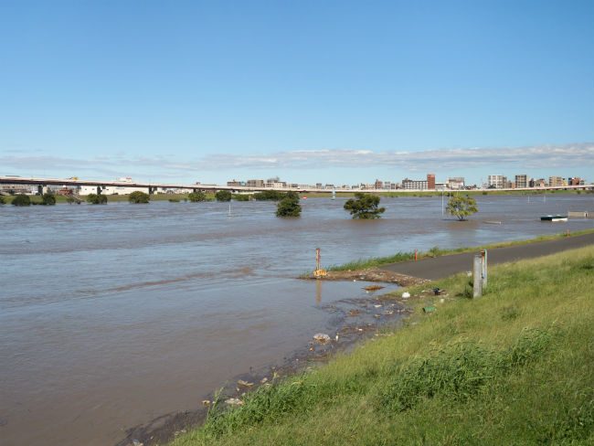
In Japan, a lot of land where people live is lower than the river level at the time of the flood. High embankments are built along the river however, if these embankments break down, they would immediately cause enormous damage to people.
River level in Tokyo (Edogawa / Arakawa / Sumidagawa Rivers)
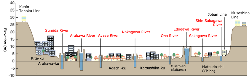
Image translated from "Ministry of Land, Infrastructure, Transport and Tourism"
River level in London

Image translated from "Ministry of Land, Infrastructure, Transport and Tourism"
River level in Paris
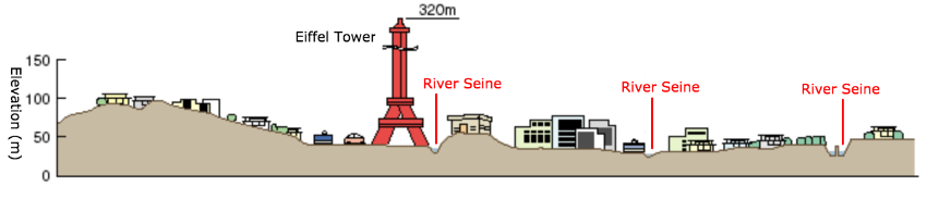
Image translated from "Ministry of Land, Infrastructure, Transport and Tourism"
River level in New York
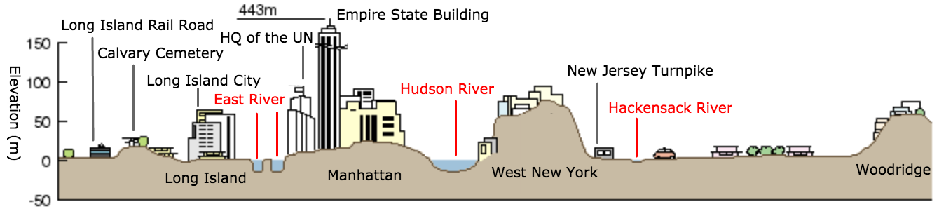
Image translated from "Ministry of Land, Infrastructure, Transport and Tourism"
What is Inland Flooding?
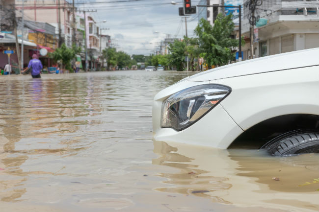
Apart from River Flooding and Coastal Flooding, there is another flooding called Inland Flooding. It's caused by heavy rain in a city and it overflows on the ground surface.
When heavy rain falls, it will not be able to to drain the water just by gutters, sewers and drains. Also, if the water level of the main river rises in the area where tributaries join together, the main river water can flow back to the small and medium-sized rivers (tributaries).
The amount of damage caused by Inland Flooding in Japan is about 50% in total floods (river flooding, coastal flooding and inland flooding) however, about 80% of floods in Tokyo are caused by inland floods. In urban areas where embankments are well developed, inland flooding has become a new issue.
Inland Flooding occurred by the Typhoon 19th in 2019 and caused damage around Musashikosugi Station. The increased water of the Tama River flowed back through the sewer and overflowed into the city.
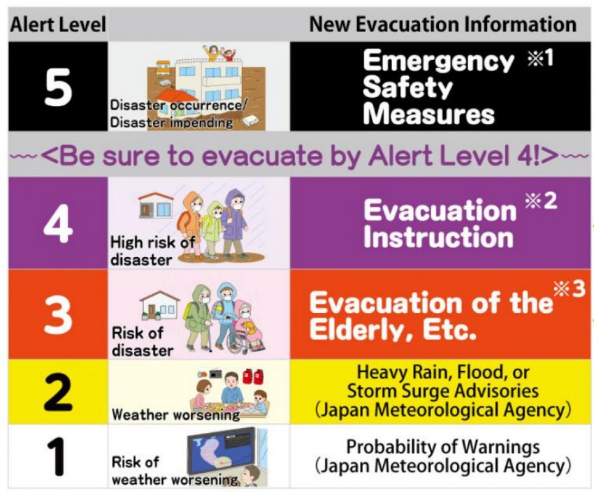
Flood / Landslide Warning Systems and Disaster Prevention Information
The disaster prevention information is specified by 5 levels of warnings so that the residents can easily understand intuitively the actions to be taken. The disaster prevention information is published by the local government and the Japan Meteorological Agency.
When the local government issues an evacuation advisory (warning level 4), or an evacuation preparations or evacuation of elderly people (warning level 3), take action immediately.
When evacuating, you don't have to choose to go to the pre-designated evacuation site, but you can consider evacuating to the upper floor of a sturdy building nearby, to be away from rivers and cliffs. It is important to take action according to the situation.
Evacuation Terms in Japanese
- Evacuation Order (避難指示 hinan-shiji):
- This will be announced when the level of danger is imminent (Alert Level 4). Once this is announced, please evacuate to the safe site.
Warning System by Japan Meteorological Agency
Click the image to see more details from the Cabinet Office.
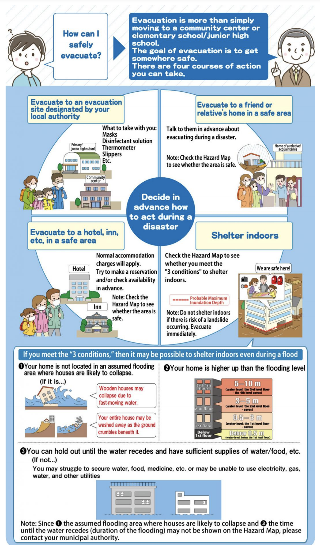
How to Evacuate
Click the image to see more details from the Cabinet Office.
Hazard Maps
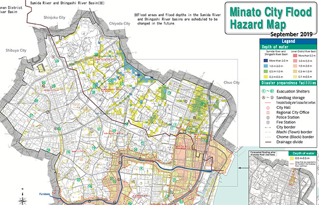
Each city has its own Hazard Map, sometimes they have it in English. Please contact the city center where you live in for details.
These websites from Japan Meteorological Agency are also very useful.
Real-time Flood Risk Map
https://www.jma.go.jp/en/suigaimesh/flood.html
Weather Warnings/Advisories
https://www.jma.go.jp/en/warn/
Other Useful Links Related to Natural Disasters in Japan

・Japan Typhoon Season: How to Prepare for a Disaster
・Free Apps and Websites to Protect You from Natural Disasters in Japan