English Maps of Yokohama
When a foreign expatriate stays in Yokohama for a long period of time, first of all, it is necessary to grasp the Yokohama area and then search for a residence while considering commuting routes and children's school routes. Among various types of maps, we will introduce the recommended English map of Yokohama, route map, and application.
Yokohama Map
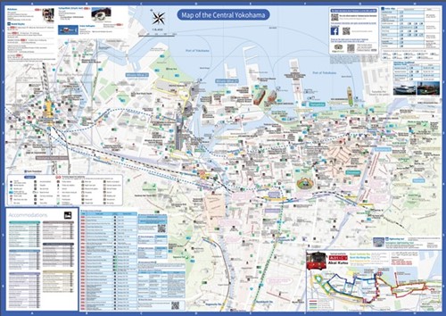
A map where you can see the entire city of Yokohama. It is introduced by areas such as around Yokohama Station, Minatomirai, Chinatown, Shin-Yokohama Station. Useful information about foreign currency exchange facilities, ATMs, duty-free shops, etc.
Tokyu / Minatomirai lines Route Map
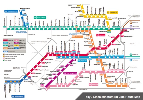
Route map from Tokyo to Yokohama city issued by Tokyu Corporation. There are 9 lines of stations operated by Tokyu Corporation and JR/private railways.
Yokohama Bus Route Map
A site where you can search for routes, maps, and timetables of municipal subways and municipal buses of the Yokohama Municipal Transportation Bureau in English.
Yokohama City Transportation Bureau English search site
Yokohama Visitor’s Guide Book
A guidebook introducing sightseeing spots in Yokohama city. Introduces business hours and fees of tourist facilities and commercial facilities by area.
Yokohama offline Map and Travel Trip Guide for IOS
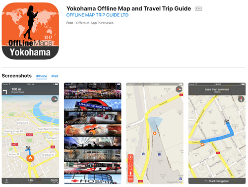
Offline map app for Yokohama for iPhone and iPad. Information on tourist facilities and stations in Yokohama city.